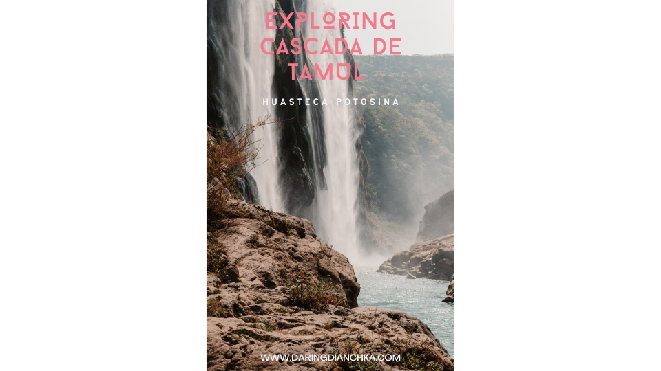
EXPLORING CASCADA DE TAMUL
ABOUT TAMUL – THE JEWEL OF THE POTOSINA WATERFALLS
When I came across Cascada de Tamul online I was instantly drawn to it, I was in disbelief that such a beautiful site was not widely known, except locally. There was little to no information about it. If you don’t know by now, I love a good challenge hence the name “daring” dianchka. I dedicated time researching the best way to explore Tamul with the help of friends who grew up in the region.
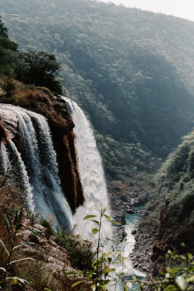
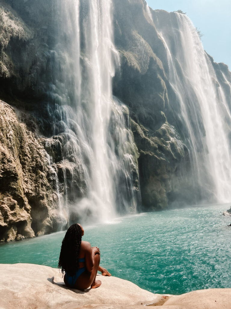
Tamul is a spectacular turquoise colored waterfall sitting tall at 344 feet (105 meters). The tallest in San Luis Potosi Mexico, which is formed by the Gallinas river cascading into the Santa Maria river.
There are numerous and almost equally gorgeous waterfalls in Huasteca Potosina, a small region in San Luis. If you do not have time to visit them all, Tamul should make the short list.
HOW TO GET TO CASCADA DE TAMUL
Cascada de Tamul is located in the Huasteca Potosina region of San Luis Potosi in Mexico. To get to Tamul, you will definitely need a vehicle but the season (rainy or dry) will determine what kind. If you are visiting during dry season (October to May), a compact car will do just fine. Outside of those months, a 4×4 high clearance vehicle is highly recommend. If you are coming from San Luis International Airport it will take 3 & 1/2 hours with tolls. Without tolls you’re looking at an additional 30 minutes. If you are coming from Cuidad Valles, the only town with airbnb and hostels it will only take 1 hour.
The directions to Tamul are a bit tricky depending on if you are hiking or taking a guided canoe tour. If you prefer a tour you’ll want to head to the towns of Tanchachin or La Morena. Just enter either of those towns into Google Maps and it will lead you there directly. Both towns are only 10 minutes from each other and have departure points for the canoe. The canoe takes up to 20 people on a 2 hour upstream paddle. It is beautiful but crowded which motivated me to find the trailhead instead.
If you are feeling adventurous and prefer to hike, you absolutely can but be careful of local guides who will try to convince you it is impossible. It’s not and it tooks us a few tries and two lovely locals who pointed us in the right direction. You also don’t need a guide contrary to what I read online. Locals who worked for the guide company assured us a guide was not mandatory to hike and that they were wrong to mislead us, as of April 2022. You will need to print out or download the google map directions though because there is no cellphone service.
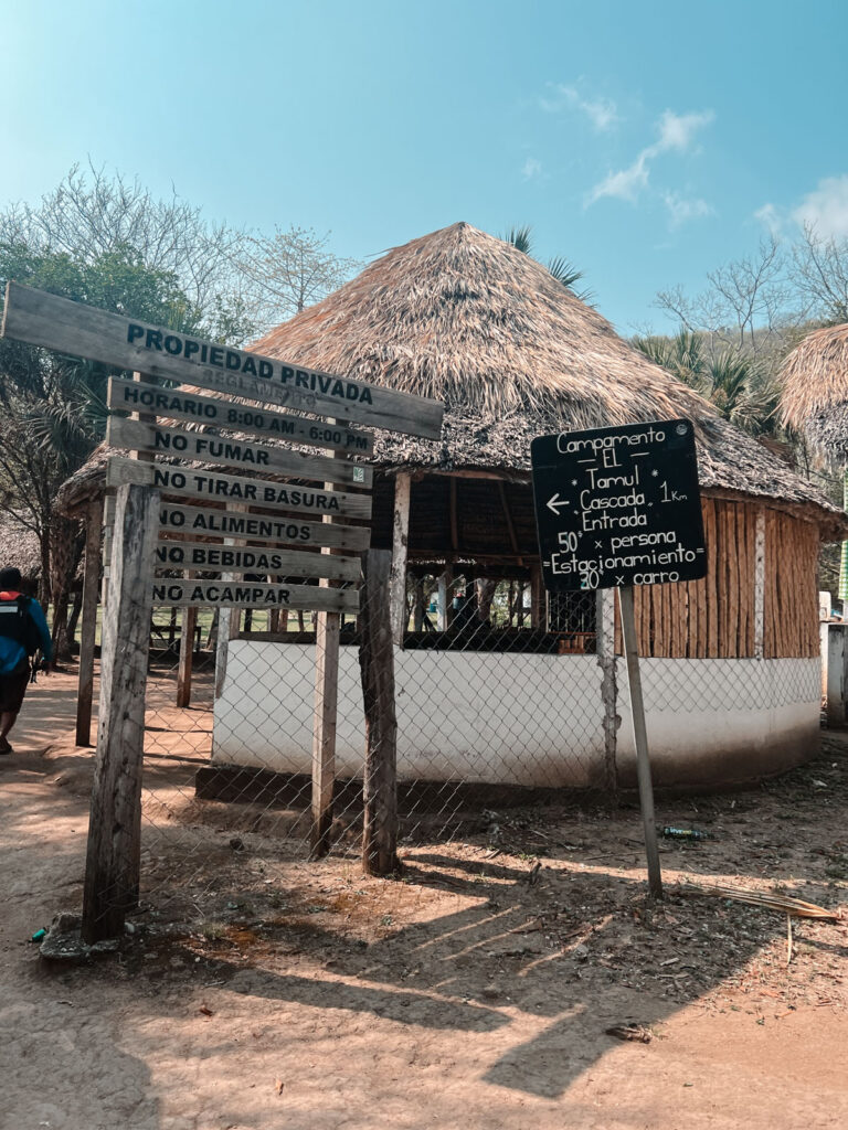
To get to the Tamul trailhead parking, enter into Google Maps “Campamento Tamul” and it will lead you here. You will pass through two towns, El Sauz & El Naranjito. Once you get to El Naranjito keep straight, do not ask for directions! Trust your map and GPS, they will bring you to Campamento El Tamul. The road leading there is unpaved and rocky so drive slowly. Before you get to Campamento Tamul you’ll pay 20 pesos to a local man to access the campground. This is because the road is on his private property. You will then pay another 50 pesos when you get to the campground for parking.
HIKING CASCADA DE TAMUL
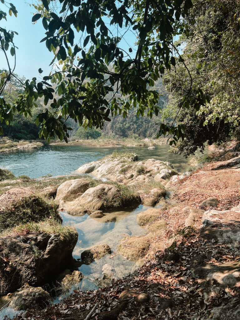
Now that you’ve made it to Campamento Tamul, follow the signs to the trailhead, you’ve made it! The trail itself is not marked but well beaten down so just follow the path. You’ll be walking right next to the Gallinas river and can swim in any spots that are clean and flowing. Please use your best judgement.
Once you’ve made it to the end of the river there’ll be stairs to the right about 50 feet away from the end of the river. It’s time to descend. Halfway down, the stairs are in decent shape. The remaining half are quite sketchy so maintain 3 points of contact the rest of the way down.
Take in the beautiful scenery because it is out of this world, I’m a huge nature lover and it made me tear up a bit.
If you are a great swimmer and in good physical condition then the adventure does not end here, please DO not proceed unless you are as described. There should be a rope in the Santa Maria river that stretches horizontally from one end to the opposite end. Find a path down to this rope and swim across while holding on to the rope.
Once you’re at the opposite end climb up the rock and over to the other side and get into the water again to swim further towards the waterfalls while sticking as close to the rocks as possible. Not many people have ever done this, only some of the local guides, due to the current so again use your BEST judgement.
This spot is spectacular because if you look closely, in between the two falls at the very bottom, the rocks look almost like perfectly chiseled faces. The locals told us of a legend about giants that used to live, here protecting the area. If you make it this far PLEASE tag and reach out to me on social media, I’d love to see it! We hung out for about 30 minutes feeling the breeze spray cool mists of the falls on our bodies, listening to the falls and enjoying the peace. It was pure magic.
To return, simply retrace your steps back up the mountain.
If you are unsure of what to pack for this trip check out my Adventure Travel Packing List blog post. It includes different combinations of items to pack for different types of trips (hiking, backpacking, diving, snorkeling, etc.)
Leave a Reply
You must be logged in to post a comment.


Before you go, be sure to subscribe so you don't miss out on the latest blog posts, opportunity to travel with me and more!


Itís nearly impossible to find educated people in this particular subject, however, you seem like you know what youíre talking about! Thanks